- Menu
- Featured Items Of The Week
-
WWI & Before
- Civil War / GAR
- Indian War / Spanish American War
- WWI - Cloth Insignia
- WWI - Enlisted Collar Disc
- WWI - Officers Type Collar Insignia
- $25.00 and under WWI - 1920's insignia
- WWI - Ephemera & Photography
- WWI - Medals & Metal Insignia
- WWI - Misc. ( Trench Art, Paperwork, Patriotic,etc..)
- WWI - Uniforms, Headgear & Footwear
- Field Gear and Equipment
- Japanese - WWII And Before
- German - WWII And Before
-
US WWII Era ( 1941-1948)
- Anti-Axis Items
- ASMIC's Quality Collection / Most Wanted Insignia
- Cloth Insignia - Army
- Cloth Insignia - Army - Theatre Made & Bullion
- Cloth Insignia - State Guard
- Cloth Insignia - Army Air Forces & Related Patches
- Cloth Squadron Patches - Army Air Forces
- Cloth Insignia - US Marine Corps
- Cloth Squadron Patches - US Marine Corps & US Navy
- Cloth Insignia - US Navy
- $25.00 and under WWII era insignia
- Museum Insignia Fundraising Page
- View more →
- Korean War Era (1948 - 1956)
-
Vietnam Era (1957 - 1975)
- Martha Raye Collection / Estate
- Cloth Insignia - Special Forces
- Cloth Insignia-- Army Aviation, Cavalry & Transportation Pocket Patches
- Cloth Insignia - Army Infantry, Medical, Novelty, Etc. Pocket Patches
- Cloth Insignia - Army Scrolls & Tabs
- Cloth Insignia - Army Shoulder Sleeve
- Cloth Insignia - ARVN - Airborne
- Cloth Insignia - ARVN - Air Force
- Cloth Insignia - ARVN - Army
- Cloth Inisgnia - Army - Nationalists Field Police / NPFF
- Cloth Insignia - ARVN - Navy & Marine Corps
- Cloth Insignia - ARVN - Ranger
- View more →
-
Other Militaria
- Southern California Mega Collection
- Other Collectibles
- MASH CO
- Books
- Militaria 1911 Reproduction Tiger Stripe Uniforms
- Vintage Clothing & Accessories
- Vintage Advertising
- Archive Of Previously SOLD Items
- cloth
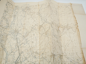
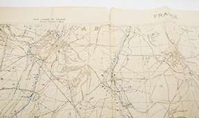
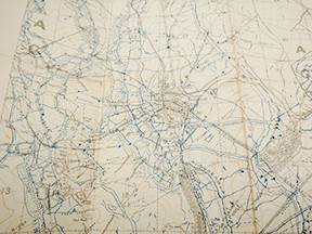
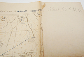
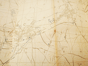
WWI era Tactical Map of Bellicourt/St. Quentin. Blue lines shows the German trench system. Dated to just a few days before the big attack by the Americans and Australians in that sector. Has been folded for a long time but still in good shape with just some discoloration and wear around the edges and some of the folds. Made of a rubberized material. Dated to 1918. Measures approximately 22 x 34 inches.
Vintage Productions
Militaria Resources
© 1995 - 2025 Vintage Productions. Powered by One Touch Design

